Pipeline Drone Inspection Services (UAV Inspection & Aerial Surveys)
Fairtex provides advanced drone inspection services for pipelines, tanks, vessels, and industrial structures using certified UAV pilots and industrial-grade inspection drones. Our aerial inspection solutions support safe, efficient, and high-accuracy asset assessment across onshore and offshore environments.
Drone-based inspection significantly reduces the need for scaffolding, rope access, and confined space entry while improving inspection speed, safety, and data quality. The service is widely applied across oil & gas, power generation, renewable energy, and heavy industrial facilities.
Typical applications: pipelines, storage tanks, pressure vessels, flare stacks, chimneys, offshore platforms, wind turbines, solar farms, transmission towers
What this service covers
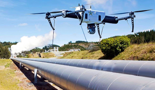
Pipeline Drone Inspection & Survey
Aerial inspection of pipeline corridors for visual assessment, leak indicators, corrosion mapping, and right-of-way condition monitoring.
Tank, Vessel & Flare Stack Inspection
Drone-based internal and external inspection of storage tanks, pressure vessels, chimneys, and flare stacks in hard-to-reach environments.
Offshore Platform & Marine Structure Inspection
Inspection of offshore assets including jetties, platforms, and marine structures with reduced operational disruption and improved safety access.
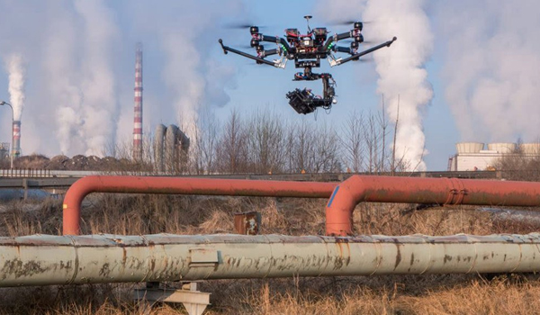
Aerial Gas Leak Detection
Detection of gas leaks and abnormal emissions using UAV-based visual and sensor-enabled inspection methods.
Photogrammetry & Survey Mapping
High-resolution photogrammetry for pipeline route mapping, terrain modelling, and asset documentation.
Wind Turbine & Renewable Energy Inspection
Inspection of wind turbines and solar farms for blade damage, structural defects, and operational integrity assessment.
Power Infrastructure Inspection
Aerial inspection of transmission lines, substations, towers, ducts, and power plant structures.
Safety Surveillance & Emergency Response
Drone-based safety monitoring, incident response support, and site surveillance for hazardous or restricted environments.
Key Takeaways
- Reduces downtime through fast, non-intrusive inspections
- Improves safety by eliminating high-risk manual access
- Supports pipeline, tank, offshore, and power infrastructure
- Provides high-resolution aerial survey and inspection data